
Main map:

Click on the picture for a bigger, printable verson. ESSENTIAL
for the game! Grid references given by Mr Harvey will refer to this map only.
Street map:
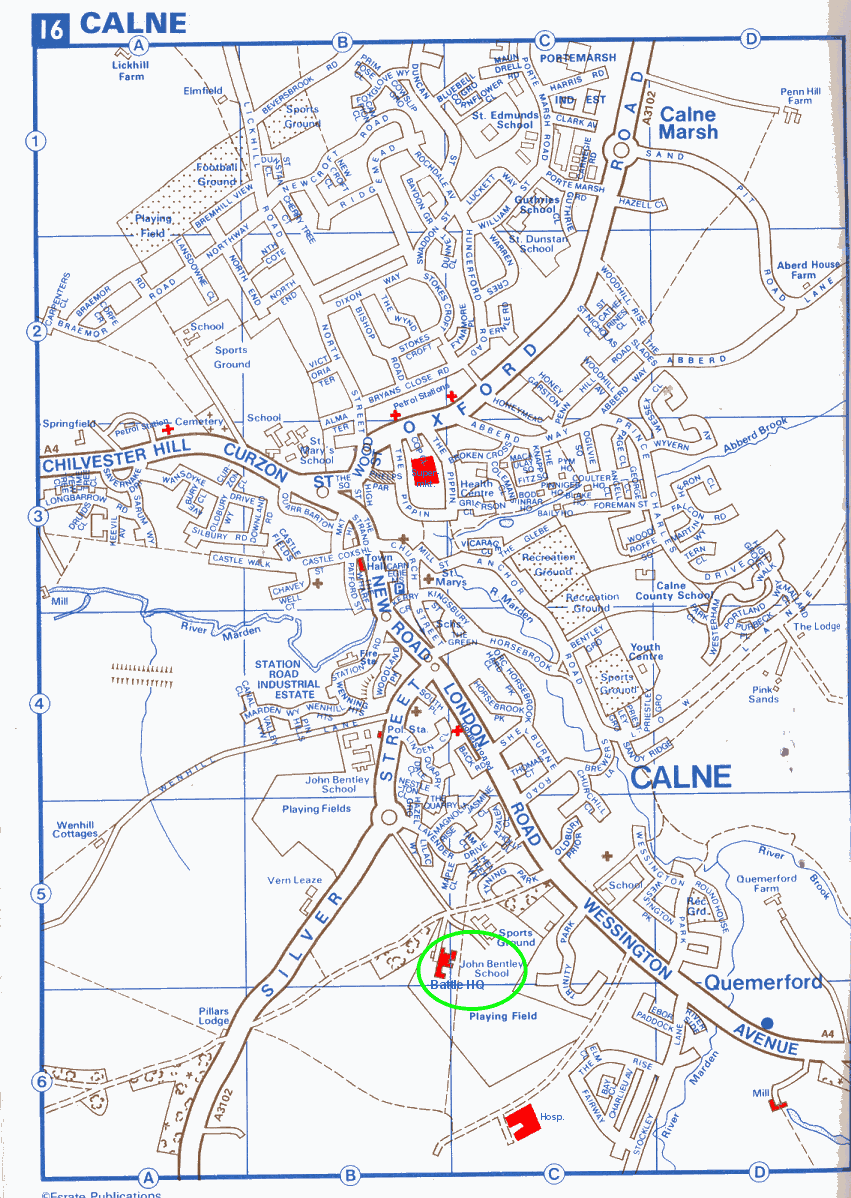
Click on the picture for a bigger, printable verson. ESSENTIAL
for the game!
Objects of interest (Main map)
Phone box: A3, E1
Fisher's Brook: A7 to C1
Old canal (blue dotted double lines): C1 to F6
Town Hall: F6
Small pond: B9
Industrial Estate: c7
Calne Marsh: D8
Chemical Works: D2
Concrete Works: D9
Sandpit: E10
The Moor: F1
Bowood Lake: G2 to J2
Castle and Moat: G4
Battle HQ / School: H6
Disused school: G6
Transmitter: H6
Old Mill: H8
Car museum: I7
Camp site: J7
Hospital: big building in I7
Town centre: E7, F7, marked by two churches
Old railway line: D1 to F5
Bowood Stately Home: H1
Petrol Stations: + signs at G7, E5, E6, F6
Fire Station: F6
Objects of interest (Street map)
Battle HQ/School: B5, C5
Disused school: B4
Hospital: not marked on map, resides in C6 on edge of playing field, on dotted
road.
Police station: B4, marked as Pol. Sta., by disused school
Fire station: B4, marked as Fire Sta.